
Local Cody, WY Trails
Jul 202023WHETHER A SHORT WALK OR A VIGOROUS HIKE, CODY HAS MUCH TO OFFER WITH TRAILS IN OR CLOSE TO TOWN.
Photos courtesy of Robyn Rogers
In Town Favorites:
Each neighborhood in Cody has sidewalks and playgrounds for casual walking or jogging, and you will see bicycle riders everywhere. On the in-town trails, you will meet friends and families with their dogs and jogging strollers where everyone is courteous. Here are some favorites but keep in mind that they border the city and that you still need to keep your dog on a leash and be aware of bears and snakes.
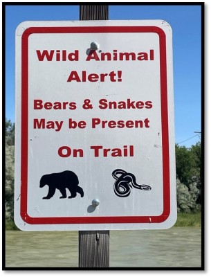
Photo courtesy of Robyn Rogers
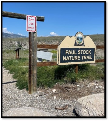
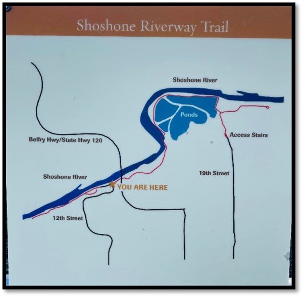
There are two trail choices below the hospital beside the Shoshone River, Paul Stock Nature Trail and the Shoshone River Trail. You can access them off Riverview Drive or off 12th Street. Always a good idea to take along bug spray when hiking by the river, especially the Shoshone River Trail (12th Street) which is mostly paved and flat with lots of vegetation. The Paul Stock Nature Trail (Riverview Drive) is gravel with ups and downs where a hiking pole is worthy of taking along.
Photos courtesy of Robyn Rogers
Beck Lake Park Complex is located at 2401 14th street in town behind McDonalds but be aware there is a gate, and it is a day use only park closing at night. At Beck Lake you can fish, grill, take your dog for a swim at the dog park, there is a bicycle trail, public restrooms, a paved walking path around the lake and it is handicap accessible. You can also access a ridgeline walk with sweeping views of the mountains around Cody.
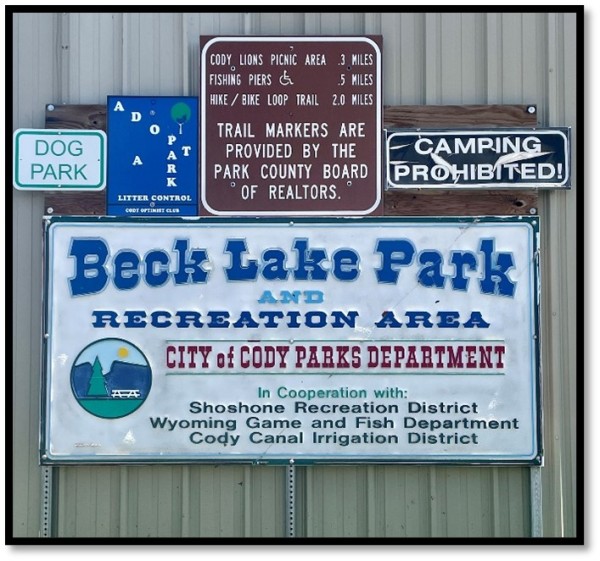
Photo courtesy of Robyn Rogers
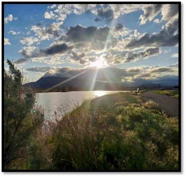
Photo courtesy of Sheree Bullock
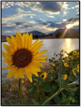
Beck Lake
Photo courtesy of Sheree Bullock
Close to Town Favorites:
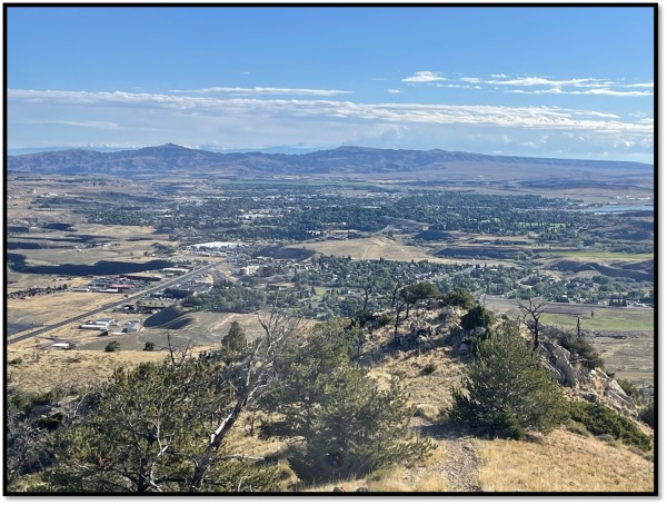
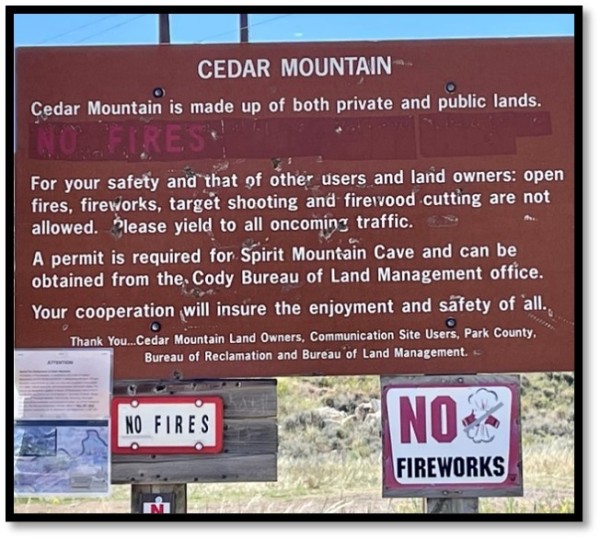
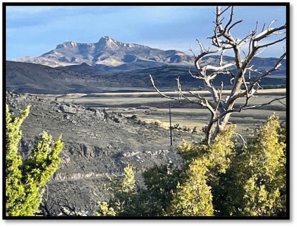
The same rules apply, you still need to keep your dog on a leash and be aware of bears and snakes and make certain to take water. On the east edge of town toward Yellowstone, you will see Cedar Mountain on the left and Rattlesnake Mountain on the right. Just past the rodeo grounds there is a sign for trail rides on the left and a dirt road before it, that leads up Cedar Mtn. There is a parking area immediately on the right with steep rocky dirt trails weaving in both directions off the road that continues upward. You might run into horseback trail riders, mountain bikers or people bouldering on your hike. This can be a short invigorating hike with great views of the town of Cody, the river, and Heart Mountain, or a longer hike that continues up and around Cedar.
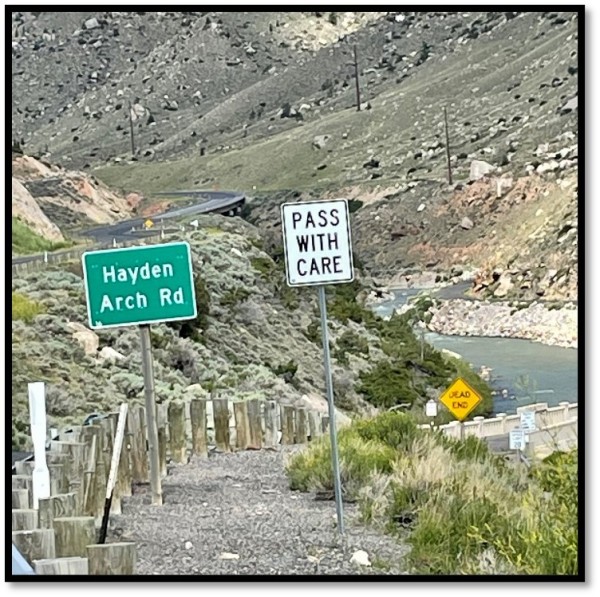
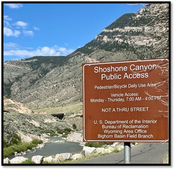
Continue driving past Cedar Mountain and around the curve, and you will see the tunnels coming up leading to the Buffalo Bill Dam and Visitor Center and beyond to Yellowstone National Park. A beautiful and tranquil walk awaits by the river below the damn. Watch for the sign, Hayden Arch Road, and turn right to find limited parking before or after the old bridge at the Shoshone Canyon Public Access sign. This is a paved road that meanders down to the river and then back up, towards the dam on the riverside. Along the road you will see rock climbing holds up the cliff side, left for serious climbers. The end of the walk is the only place where you can see the wooden ladder left by workers on the dam around 1910.
Photos courtesy of Robyn Rogers
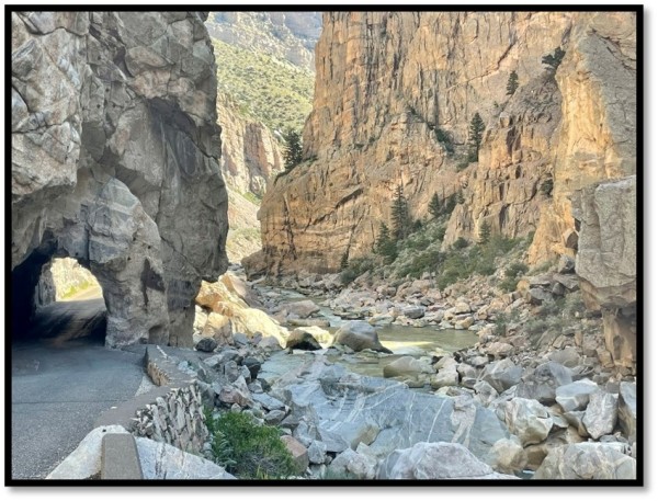
Original Tunnels
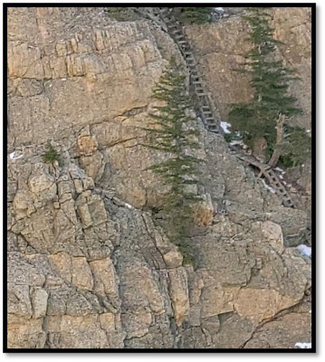
Wooden Ladder Left by Workers on the Dam
(Approximately 1910)
Photos courtesy of Robyn Rogers
Heading north out of town towards Billings, Montana, look for a brown sign on the highway that says Newton Lakes Public Access Area. Turn left. You will see the green sign and continue to drive past the shooting complex sign to a parking area just before the Newton Lake turn off. You can’t miss the large white boulders boarding the park area. If you cross the cattle guard, you’ve missed the hike parking area. After parking, walk to the end of the road by the fence where you have access to cross over to a trail. Rolling hills will take you up to an impressive view of the valley at Trail Creek Ranch. The rocky path is best with hiking boots.
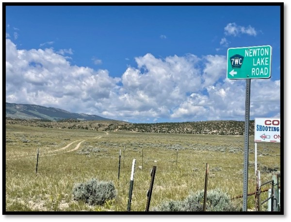
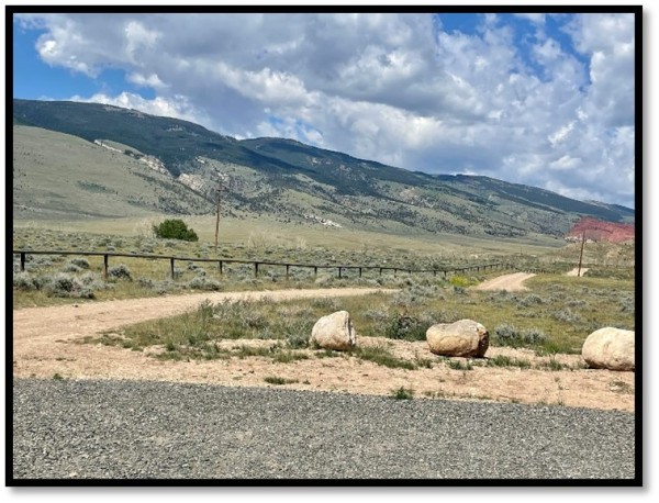
Photos courtesy of Robyn Rogers
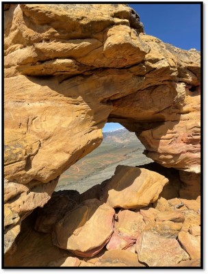
View from above Newton Lake
Photo courtesy of Robyn Rogers
There are so many more great hiking areas. Off the Greybull Highway you can explore the Archery Range Trail and McCullough Peaks. In the Clark area is Rocky Creek Road and endless more areas to discover like Deep Lake and Bridal Falls. Up the Northfork Highway toward YNP is Sheep Mountain Access Trail, Blackwater Creek, Four Bear Creek Trail, Clocktower Creek, and Elk Fork Creek, just to name a few. In the Meeteetse area is Francs Peak, Cascade Creek and the ghost town of Kirwin.
In every direction out of town you can find great hikes and bike trails of varying intensity. Stop in to one of our local bike shops for favorite trails or look at an app like AllTrails for ideas of where to go, difficulty, distance, and maps to download and much more information. Summer is finally here so enjoy the Cody area and be safe.
AllTrails App